Archive
Game Environment Cartography
Developing a map for an Interactive Fiction environment can be challenging especially if the game is based on real-world geography, as is the Historical Williamsburg Living Narrative. A large part of the value of this game is the historical accuracy–which not only includes the events of the time but the geography and architecture as well. In designing the game map, I am considering external landscape and building floor plans separately, and here I describe the process by which the external landscape portion of the game map was developed.
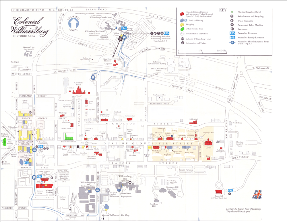
I started working from the map provided by the Colonial Williamsburg Foundation for guests visiting the city. Below is a scanned version of that map, already partially “cleaned up” (that is, much of the extraneous information–modern buildings, bus route lines, restroom symbols, etc.–have already been removed). After working with this map for a brief period of time, I found a few characteristics I didn’t like. Most significantly, there wasn’t a sufficient level of detail regarding building shapes and grounds, and the relative sizes, locations, and distances between buildings wasn’t accurate enough for me to use in creating descriptions.
At this point I changed my approach. In order to ensure fidelity to the actual physical layout of Williamsburg, I decided to use satellite imagery for the initial layout work. Google Maps provided excellent resolution from the Governor’s Palace in the north to the Public Hospital in the south, and the College of William and Mary in the west to Christiana Campbell’s Tavern in the east. The city’s overall layout was depicted quite clearly.
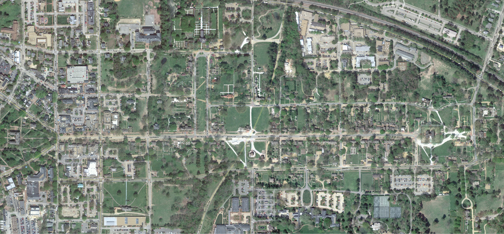
Once I had an accurate map from which to work, I was able to select the significant buildings, associated grounds, and pathways between that the player would be using. I superimposed this image on top of the map, and this gave me the level of detail I wanted for development.

Peeling away the city map, this is what the initial pass at the game map looks like. While this map contains all the information needed to create accurate location descriptions (for example, it will be important to note the distance of the College of William and Mary from the city proper), this version of the map is a bit difficult to work from in building the Interactive Fiction navigation scheme. For that task, a logical map is more appropriate.

This logical map was built from the physical line map (above), connecting locations using only the eight compass directions, and not taking into consideration the sizes of buildings or their actual distance from each other. Also, no assumptions can be made between “nodes” in the map below if they are not connected by a direction line. In other words, if a node is to the west of another node, but they are not connected by an east-west line, they may not be precisely east and west of each other. This map simplifies and compresses the physical map information for ease of navigation programming. The yellow nodes represent place locations where the player may go, while the blue nodes represent buildings or structures that have additional rooms or internal locations not depicted here. Those additional locations will be represented in further mapping exercises.
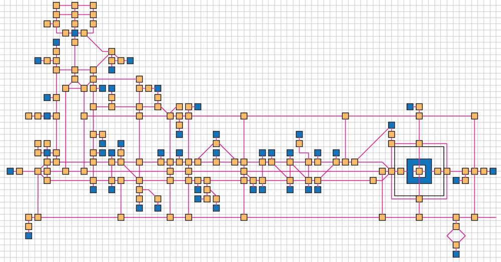
By using this logical map along with the visual information obtained from the line map superimposed from the Google satellite image, I will be able to create rich in-game descriptions of the physical Williamsburg environment. For example, an east-west running path on the logical map may actually be a long, curved road on a hilly slope, and that level of detail will be captured in the game for a rich and hopefully satisfying experience.
The Horizon Report > 2013
Since 2002, the NMC (New Media Corporation) has been publishing a series of Horizon Reports meant to provide insight into the up-and-coming technologies that would have impact in education. In the Horizon Report > 2013 for Higher Education, one of the impact categories identified is “Games and Gamification.” The Historical Williamsburg Living Narrative project was cited as an example in the report.
As game play continues to be a major focal point of discussions among educators, some believe that gamified learning is merely a trend, and carries the danger of immediately disenchanting students if executed poorly. To negate this challenge, more universities are partnering with organizations and companies skilled in game design to develop and integrate games that are relevant to the curriculum and to students’ lives. Games and gamification in education include a broad set of approaches to teaching and learning, and when implemented effectively, can help with new skill acquisition while boosting motivation to learn.
Download a copy of the Horizon Report > 2013 for Higher Ed and check out the Historical Williamsburg Living Narrative entry on page 22, under the category of History.
Interactive Fiction in Education
There is much conversation around the use of computer games in education, but the development of custom game content is often trivial “drill and practice” applications, or the implementation of off-the-shelf games don’t align well–if at all–with curriculum learning objectives. Interactive Fiction (the genre of the Historical Williamsburg Living Narrative) may be ideal for the teaching and learning environment. This article in the Learning Through Play & Technology blog addresses the potential of using custom-developed IF as a purposeful component of curriculum.
Location, Location, Location!
The map is the thing.
While the colonial Williamsburg environment will be accurately portrayed, some locations will get a more thorough treatment than others. As construction of the game environment moves forward, these are the historic sites that will receive focused attention:
- The Governor’s Palace
- The Randolph House
- The Wythe House and Gardens
- The Courthouse
- The Magazine and Guardhouse
- The Capitol
- King’s Tavern
Additionally, there will be game activity on the Duke of Gloucester Street, and one other (very large) location that, for now, will remain unnamed–and quite essential to the core storyline.
Documenting Williamsburg and a Special Thanks
Tomorrow my family and I will arrive in Williamsburg, where we will spend the weekend and depart on Monday. The goal will be to gather research materials from the Colonial Williamsburg Foundation and perform a physical survey of the colonial city, documenting with photographs and audio notes for later transcription. Technically, while this is work, the environment will cover our days with a great measure of enjoyment.
I’d like to take this opportunity to thank one of the project backers, who also happens to be a personal friend that lives near my home (in Central Florida). The family and I left on this journey last Thursday. We drove up to the suburban Maryland area to visit my mother and sisters (who have their own families and homes between Washington, DC, and Baltimore). In my haste to get on the road, I actually forgot the camera I most wanted to use for the Williamsburg photography. (I also forgot our Williamsburg passes, but since we are annual members, I wasn’t worried about getting in.)
My wife called Marcy M., our backer/neighbor and asked if she would be able to go to our home, pick up the camera and passes, then ship everything to me in Maryland. Marcy came through, and now I’m happy to have the camera I most wanted to use for the photography!
Time for On-Site Research!
One of the exciting things about the Historical Williamsburg project is that Williamsburg is not only a real place, the historical part is to a large extent restored to the condition it was in back in the late 1700s. Research there can be very entertaining as well as informative. Indeed, the city is a living museum, but ever since my father started taking our family there 40 years ago on summer vacations, I’ve seen it as a fun rather than “educational” place to go. But I picked up a lot about American history despite that fact.
From July 13th-16th, I will be there (along with my family) taking photographs and measurements in order to build the map representation of the historical portions of the city within the game. I will be getting the layouts for the major structures such as the House of Burgesses and the Governor’s Palace, along with the interior information for several other buildings (the Courhouse, the Magazine, some of the taverns, homes of prominent residents, etc.). Hopefully the weather will be favorable! There is a lot of work to do on the game itself, but one of my goals of getting the photography work accomplished (in addition to proving me with reference materials for the in-game descriptions) is so that I’ll be able to put together the project’s coffee table photo book that will be one of the rewards for some of the folks that were Kickstarter backers for the project.
During the fundraising phase, I was asked whether or not I would be publishing the photo book for individual purchase, and honestly, I had not considered that. But it does seem like a good idea, so I think that’s a project element worth adding. I’d like to get the materials together, the layout of the book completed, and all the publishing details worked out by the end of the summer. With all the quality self-publishing options out there, I should be able to have the book available for sale, and we’ll see where that goes!
Kickstarter Funding Success!
Thanks to all 85 backers of the Historical Williamsburg Living Narrative, we reached 129% of our $1500 goal, putting us at a final total of $1937. We are quite appreciative of everyone’s most sincere support in the form of hard-earned cash.
Now comes the job of building the game! The first phase of development will be focused on the Williamsburg physical environment, building the map that the game navigation will be based on. That will involve quite a bit of research (already underway), and in a few weeks time, we will be traveling to Williamsburg to obtain photographs, make geographic measurements, and gather materials from the Colonial Williamsburg Foundation. we will keep you posted every step of the way.
In the meantime, we will take a little time to bask in the warmth of this initial success in the project’s lifecycle. We are certainly off to a very good start.
Funding Countdown for the Historical Williamsburg Living Narrative
As of this posting, the funding window for the Historical Williamsburg Living Narrative has less than 55 hours left before closing. While the current pledged amount is greater than the funding goal. additional backers would go a long way toward helping the project secure more resources, leading to a more detailed final product.
If anyone reading this post is on the fence regarding backing the project, we encourage you to go to the Kickstarter project page and make a contribution, even as little as $1. If you’re already a backer, please help us continue to raise awareness by sharing the Kickstarter project link across your social media connections.
We greatly appreciate all your generous support!
A Big Thanks to our “Enterprise” Backer
Tony Guzman gets the recognition for being our Enterprise Backer, and we’d like to extend our appreciation here. What is the Enterprise Backer, you ask? Star Trek fans should get the reference: with Tony’s funding contribution, we have hit the $1701 mark. That’s 1701, as in the number of the U.S.S. Enterprise.
We also want to thank all of our backers for being so generous. Without your help, we wouldn’t have exceeded our funding goal!
Setting the Stretch Goal
Even though the Historical Williamsburg Living Narrative has reached its funding goal, there are 16 days left in the funding period, and we want to put that time to good use. To that end, we are setting a stretch goal of an additional $500 in funding (for a total of $2000 altogether). These additional funds would go toward increased research resources and even some money to market the finished product to the target audience (educators, historians, and IF gamers).
Unlike the initial funding goal, the stretch goal does not have to be hit for us to make use of the additional funds. So at this point, every backer contribution helps us move the needle. Please spread the word and help us to continue to raise funds for the project.
